History
Corrieshalloch’s bridge, and the famine roads either side of it
In 1874 the engineer of the Forth Bridge hung a footbridge across his own gorge so people could look down. The roads you drive to reach it were built a generation earlier, by people working for relief.
History
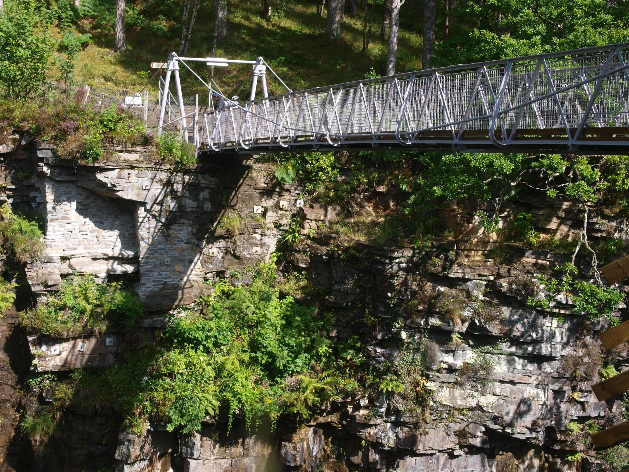
The suspension bridge over Corrieshalloch Gorge went up in 1874, and the man who built it was Sir John Fowler — the engineer behind the Metropolitan, the world’s first underground railway, and chief engineer on the Forth Railway Bridge. The gorge was on his own estate at Braemore. He was not building infrastructure. He was building a place to stand.
What Fowler actually put up
The National Trust for Scotland, which has owned the gorge since 1945, is precise about the structure: it is a suspended deck span rather than a suspension bridge in the strict sense, with cast-iron pylons, a wrought-iron deck, and cables instead of chains. It spans twenty-five metres from ledge to ledge. Benjamin Baker and John Dixon worked with Fowler on the design, and the two of them had already worked together on moving Cleopatra’s Needle and setting it up on the Embankment in London.
It hangs about sixty metres above the Falls of Measach, and it moves. That is by design, which is a sentence worth having in your head before you step onto it rather than after.
The bridge was only one piece of what Fowler did here. The Trust’s account is that over thirty years he and Lady Fowler planted around nine million trees on an estate that was mostly bare open hillside when they bought it, built a house seven hundred feet up the slope — Braemore House, since demolished — dammed lochs to generate hydro-electric power, and laid out paths and small bridges that were meant to frame views as much as to get anybody anywhere.
It is where it is on purpose
The best observation about the bridge comes from Aidan Bell, the Trust’s estate supervisor at Corrieshalloch, who has written a book on Fowler’s bridges. If all Fowler had wanted was to cross the River Droma, Bell points out, he could have put a conventional bridge in further upriver. He put a swaying one over the deepest part of the gorge instead, so that people could look straight down into it from somewhere safe.
That is a Victorian idea — the Romantic taste for the sublime, for wild ground experienced at close range — and it is the reason the place works on people now. The gorge itself is about a mile long, a slot cut by glacial meltwater, and its Gaelic name is usually translated as ‘ugly hollow’. You cannot see the inside of it on the approach; the Trust’s description is that it stays hidden until the moment you step onto the deck. That is the whole effect, and it was arranged.
The bridge is B-listed, and the Trust has a legal duty to keep it up. In 2024 it put the cost of that at around £15,000 a year for the bridge alone, with structural engineers more used to lighthouses among the people inspecting it. The reserve around it was declared a National Nature Reserve in 1967, and in 2021 NatureScot described it as Scotland’s smallest, at 6.9 hectares — measured flat, which rather undersells a box canyon.
The roads the rest of the day runs on
Here is the part that is easy to drive straight past. Corrieshalloch sits, in the Trust’s own words, between the main road to Ullapool and the Destitution Road to Dundonnell — and that second road is where the Wester Ross day goes next.
The Destitution Roads came out of the Highland potato famine of the 1840s. Gairloch Museum’s account is that the government and landlords kept people from starving through the first years of it, but that by 1848 relief was to be worked for, and one of the main things destitute Highlanders were set to was building roads between remote places in the north. The stretch from Braemore Junction to Dundonnell is one; Wikipedia’s account of the A832 says it was built to give crofters work in exchange for oatmeal rations. The museum names two more on the same day’s route: Poolewe to Gruinard, and Kinlochewe to Slattadale along the shore of Loch Maree.
The sources do not agree on exactly when each stretch was built — Wikipedia dates the Dundonnell road to the famine of 1846–47, while the museum places the work-for-relief rule from 1848 — and this post is not going to settle it. What is not in doubt is who built them and why.
So the order of the morning is worth noticing. You leave a bridge that a wealthy engineer hung over a gorge, a generation later, so that visitors could feel something. Then you spend a good part of the rest of the day on roads that hungry people were made to build in exchange for their rations. The landscape does not tell you the second story at all.
For anybody who speaks Gaelic, the museum points to a recording in the Tobar an Dualchais archive of Peter Stewart describing his grandfather’s work on the road between Ullapool and Gairloch. It is about as close to a first-hand account of these roads as survives, and it is not in English.
Where this came from
- National Trust for Scotland — the Corrieshalloch suspension bridge and cultural landscape
- National Trust for Scotland — 150th birthday of Corrieshalloch Gorge bridge (24 May 2024)
- National Trust for Scotland — Corrieshalloch Gorge National Nature Reserve
- NatureScot — Feast your eyes on this Gorge (13 July 2021, archived copy)
- Gairloch Museum — Destitution Road
- Wikipedia — A832 road
Conditions in the Highlands change quickly, and a road that was open when this was written may not be today. Check the source before you plan around anything here — or ask us, because we will be driving it.
Days this touches